December 2019
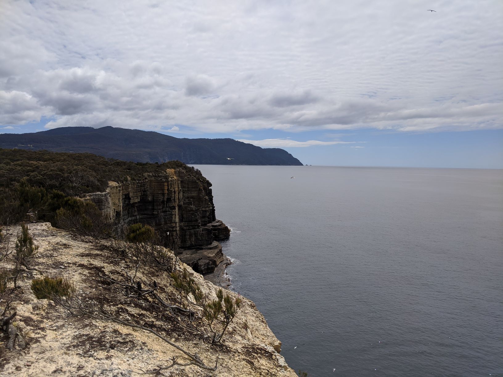
On the sail to Pirates Bay Tasmania showed us its true colours, we had overcast skies, drizzly rain and freezing cold temperatures but thankfully the seas were flat and the wind mild. The distance between Pirates Bay and Shoal Bay on Maria Island was only about 25nm, but aside from the flat seas and mild wind the conditions that day were miserable. This sail was relatively uneventful, Hugo and I took turns on lookout in the cold and wet weather, monitoring the tiller and looking out for other boats, grateful the distance we had to travel that day was relatively short. However there was a silver lining to the miserable weather, that day we witnessed some of the beautiful scenery that Tasmania is renowned for. We had huge green mountains rolling down to the waters edge, abruptly ending in granite cliff faces which sometimes continued on into the ocean in the form of small rocky islands. More often then not these cliff faces were dotted with small sea caves, giving us the impression that in the old days they would have been perfect smuggling holes, maybe where Pirate’s Bay had originally got its name from. Most of the time the tops of the mountains were shrouded in clouds, preventing us from seeing how tall they truly were but this made them no less stunning.
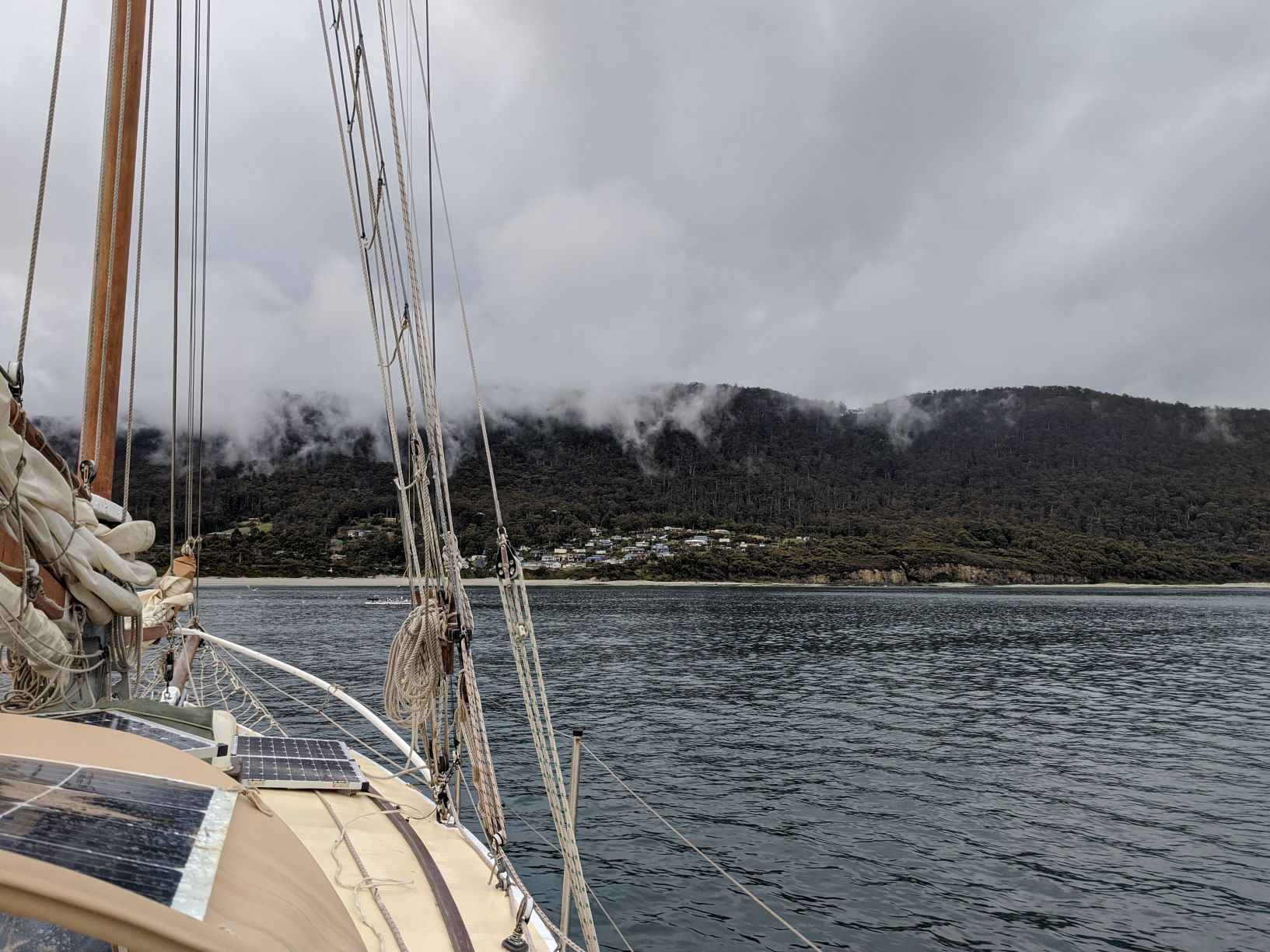
We sailed into Pirates Bay in the early afternoon and for the first time since our winter on Kangaroo Island we had to light the fire, it was that cold. With Allagai’s small fire lit the inside of the boat quickly heated up thawing us out from our sail and allowing the saturated wet weather gear to dry. Pirates Bay is another location in Tasmania with a unique geological feature which has led to it having an interesting history. The area surrounding Pirates Bay is more largely known as Eaglehawk Neck and has another isthmus (a narrow piece of land connecting to large land bodies), 400m long and just 30m wide. The isthmus at Eaglehawk Neck played a huge role in Tasmania’s early convict history in keeping the prisoners at Port Arthur from escaping off the Tasman Peninsula. Not only was this narrow stretch of land patrolled by soldiers it was also guarded by dogs in what was infamously called the “Dog-line”. The dog-line was essentially, as the name suggests, a line of dogs which were all leashed in placed. These dogs were far enough apart that they couldn’t fight each other but close enough that any escaped convicts couldn’t get through the line without being attacked. The isthmus at Eaglehawk Neck was the only way to get off the Tasman Peninsula, by land, so the Dog-line and soldiers made it nearly impossible for escaping convicts to get far, most too scared to try even attempt an escape.
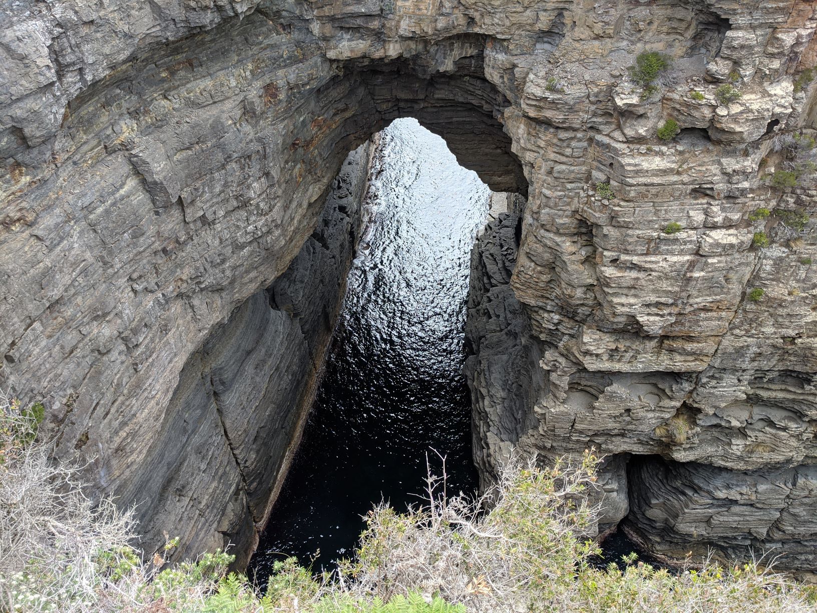
The day after we arrived in Pirates Bay the weather was completely different, not only did we have clear blue skies, it was also warm, a totally different place then the day before. Knowing that we couldn’t waste such beautiful weather I convinced Hugo to go ashore for another one of my “short” walks. When we got ashore we anchored the dinghy on the main beach and visited the nearby attractions including the Blow Hole, Tasman Arch and Devils Kitchen. The Tasman Arch and Devils Kitchen were both collapsed sea caves which had formed an arch and trench respectively when their roofs had collapsed from erosion. The Blow Hole however was still in the early days of erosion, where only a small hole in the ground was present. The site got its name because when waves rushed into the cave, particular when the swell was large, the water would be forced up and out of the hole, causing a small geyser or blow hole.
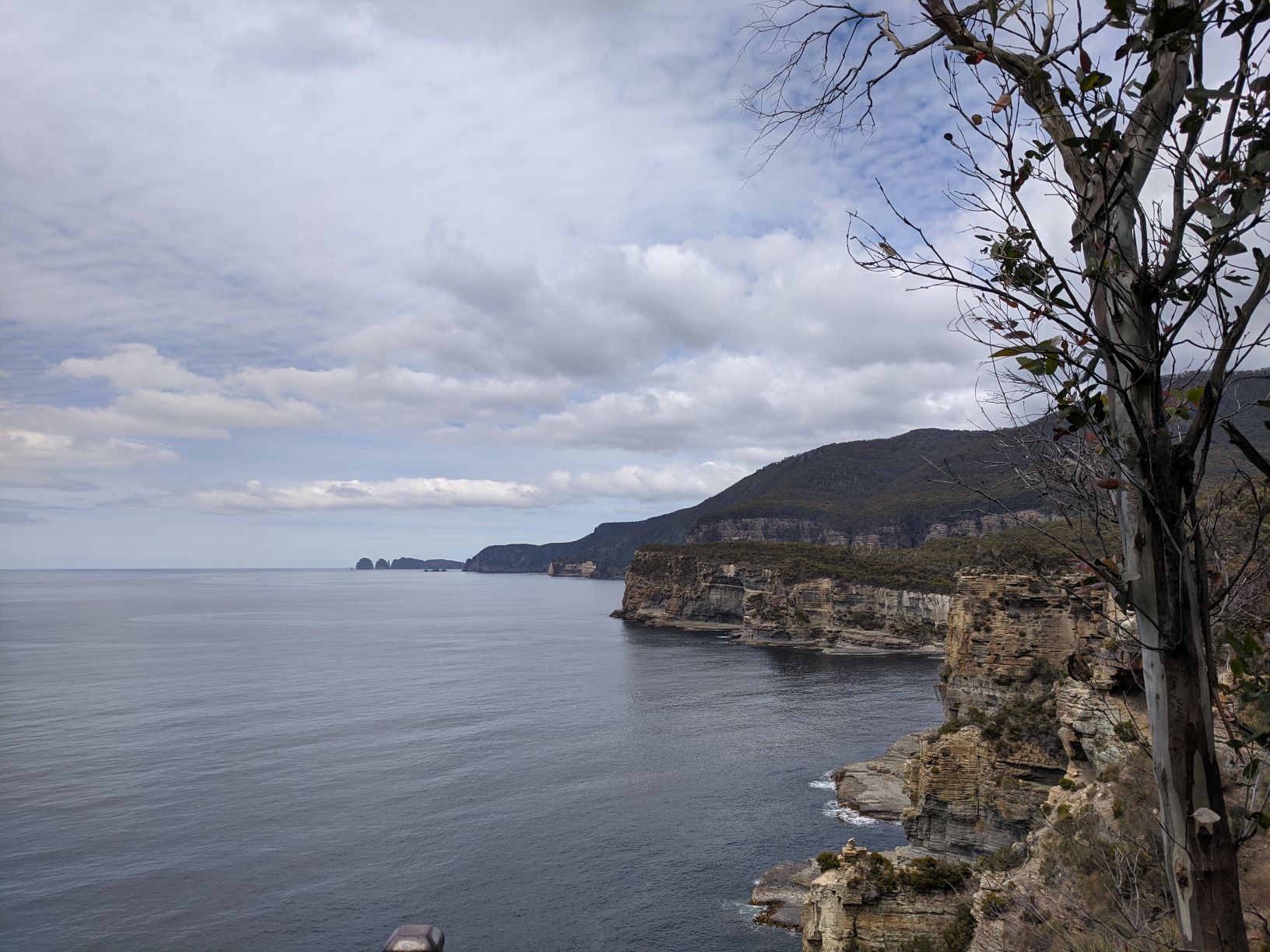
It was while we were at the Devils Kitchen that I noticed a sign for a walk to nearby Waterfall Bay, unable to resist potentially seeing a waterfall I begged Hugo that we continue walking. The walk to the bay was quite pleasant, made for the large number of tourists that frequent the area, the path was very wide and well maintained. We followed the track through lightly wooded forest which was not far from the edge of the coast and so we were rewarded with many views of the ocean and distant cliffs. Within the hour we’d made it to the lookout overlooking Waterfall Bay, however because it was summer and there hadn’t been any substantial rain the water fall unfortunately wasn’t flowing. But even though the waterfall wasn’t flowing we could still see the scar it had left in the cliff face from probably hundreds of years of flowing each winter. The bay itself was a beautiful little nook in the coastline, although probably a little small and deep to anchor Allagai in. While there we also learnt an interesting fact on the area courtesy of an information sign. Apparently Waterfall Bay is a renowned for an underwater sea cave and so is a prominent diving location for experienced divers. In fact it went as far to boast that this cave system, known as Cathedral Cave, was the largest system in Australia. According to the sign the sea cave system goes down only about 20m but was full of sea life that can normally only be found in much deeper water.
After spending some time marvelling at the area it was time to turn around and make our way back to the boat. But it was while standing at the Waterfall Bay lookout and gazing out at the ocean that we decided the weather was so good that it was too nice to not use it for sailing. There wasn’t a great deal of wind but with the clear conditions and minimal swell we were excited to see the coastline from the water, even if it meant we’d have to do a little motoring. Feeling re-energised after our “short” walk we quickly took off retracing that mornings steps getting back on Allagai just on lunch. No sooner had we stepped on board, having walked a total 8km, we were pulling up the anchor for the next leg of our adventure aiming to drop it again that afternoon in Fortescue Bay.