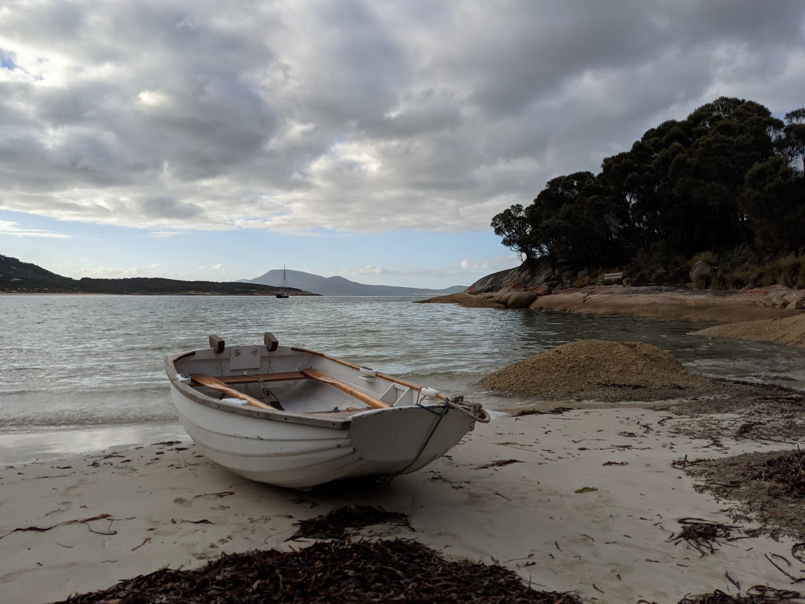
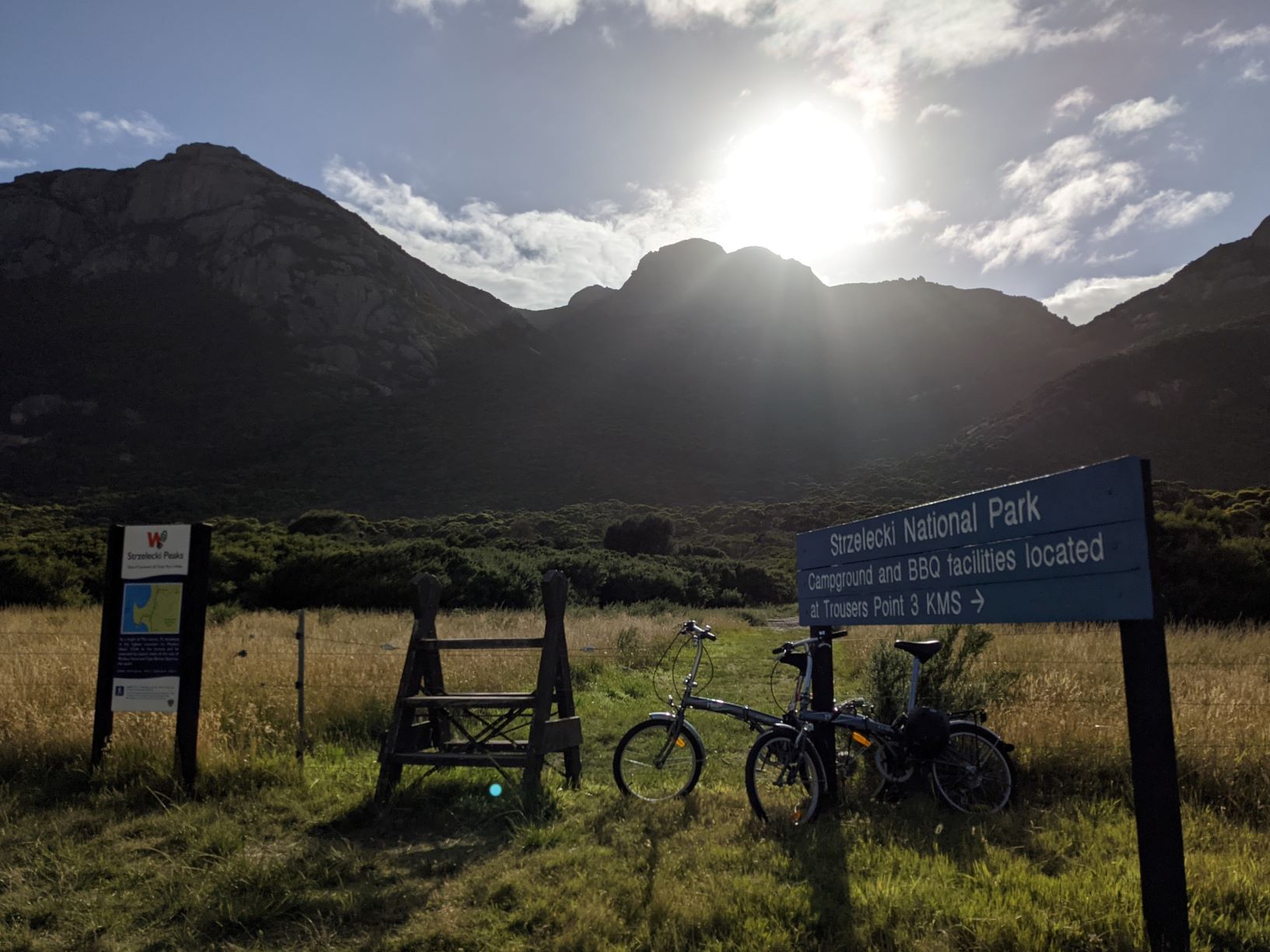
After anchoring in the shadow of the Strzelecki Mountain Range multiple times it was finally time to attempt the hike to its peak 756m above sea level. So the morning after anchoring on the southern side of Trousers Point we were up at sunrise to get ready for our hike to Strzelecki Peak. First we moved the boat closer to the main beach and picked up the public mooring and then packed our day bags for the hike. Next we went ashore and took our folding bikes with us because we were actually about 5km from the start of the trail. The bikes were a life saver and we were at the start of the trail in no time. The hike up the Strzelecki Peak started near enough to water level and went up to 756m over a 6km return track. This was the same distance but nearly double the last mountain we climbed, Mt Amos.
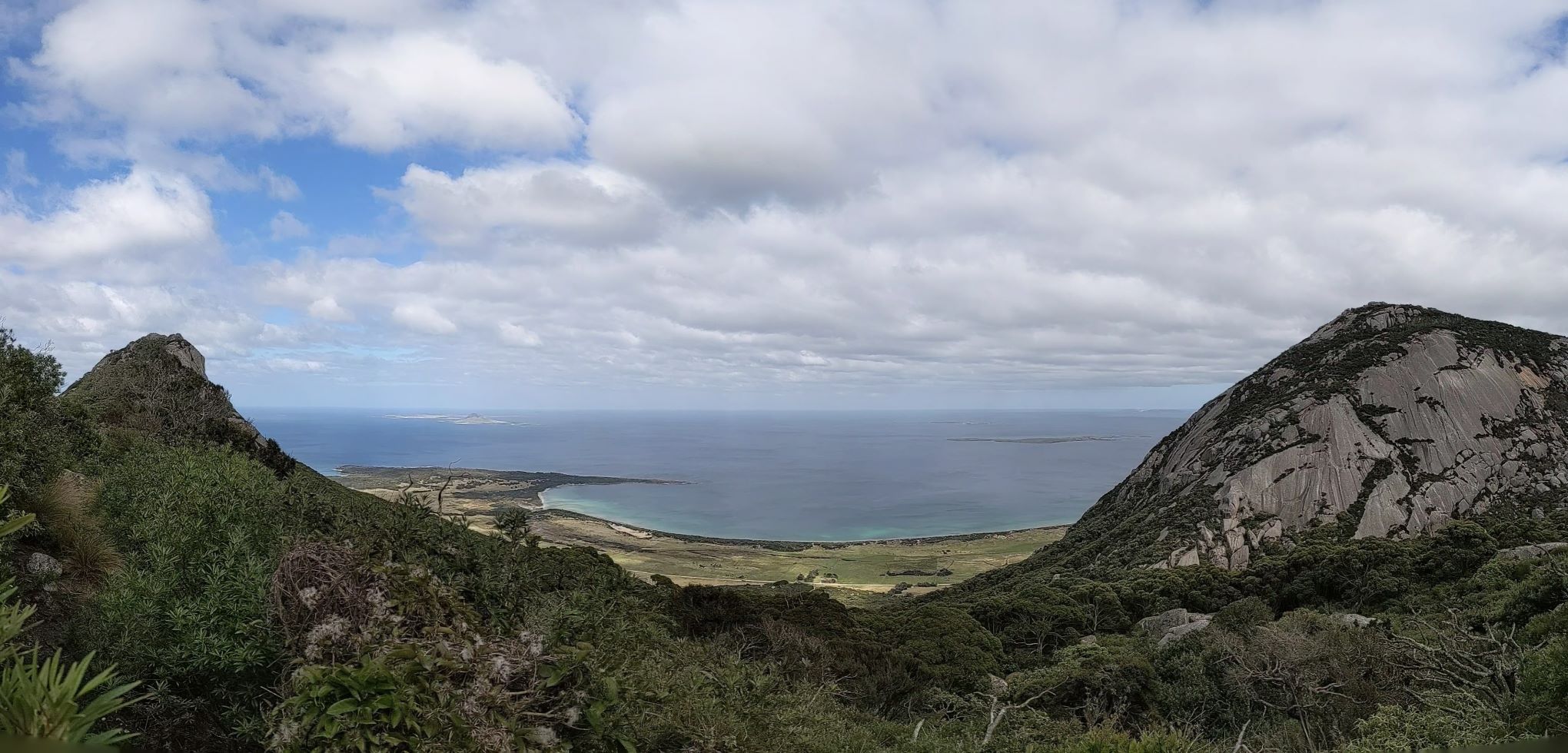
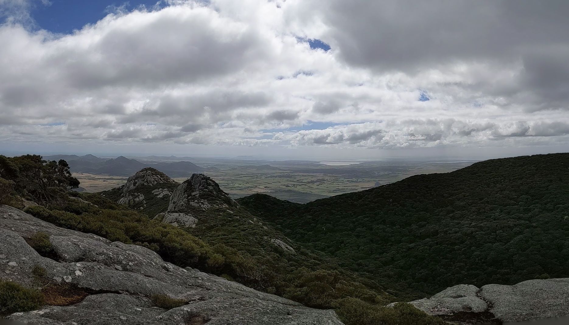
The walk up to the peak was intense and passed through many different forest types as the landscape changed and the elevation rose. The bottom of the trail start in a sparse, low lying eucalypt forest, walking alongside a small stream, however we quickly left the stream behind as we gained elevation. The next part of the walk took us through a valley between two of the smaller peaks and so we were quickly engulfed in a small rain forest. By this point in the walk the landscape was also becoming more rocky with many large boulders starting to appear. We were also being continuously delighted with amazing views of Flinders Island and the many smaller islands to the west. However these stunning glimpses were nothing compared to the view from the peak which was breathtaking and well worth the climb, with 360 degree views of Flinders Island and the surrounding waters of Bass Strait. That day there was absolutely no cloud cover, a rarity we later learned, instead we had a fine mist reducing distant visibility. But that didn’t make the view any less amazing, we had worked hard to get to the top and felt thoroughly rewarded for the effort. We probably spent about half an hour enjoying the view and resting before heading back down the mountain. The entire hike took us about five hours from the start of the trail head to the end, leaving us feeling exhausted but satisfied by our walk. However the adventure wasn’t over quite yet, we still had to ride back to Trousers point. Although the ride back to Trousers Point passed by in no time at all as thankfully it was all downhill.
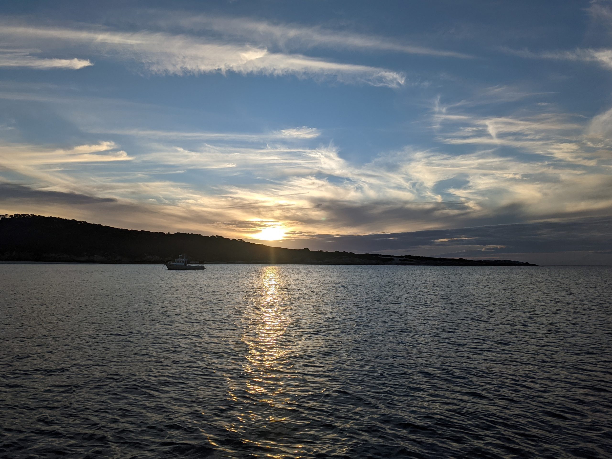
Once back on Allagai there was no time for rest as we had to move anchorage ahead of a weather change. We had another bad westerly front forecast and had decided that the best place to shelter was Lady Barron, where we had spent the last westerly blow. As much as we wanted to rest the weather the following day wasn’t going to be favourable to get up the channel. This meant that we had to move that afternoon during the calm and what we thought was meant to be slack water. So we dropped the public mooring and started motoring as with wind light winds on the nose there was no point hoisting any sails. However the journey that day took far longer then expected because we had the tide in the channel running against us, not slack as previously thought, only making it into Lady Barron as the sun was dipping below the horizon.
The following day we had relatively nice weather and since it looked like we would be in Lady Barron for a few days we decided to get the folding bikes out. It had been ages since we had been for a proper bike ride and so we were both keen to do some exploring. However once ashore we quickly realised that we were still exhausted from the mountain climb the previous day and that many of the roads to the local beaches and headlands were sandy 4WD tracks. So with that discovery we spent the afternoon riding around town instead. The next couple of days were then spent just relaxing on Allagai only moving anchorages as necessary as the wind changed. However as soon as the weather passed we once again anchored off the main beach for our next crazy adventure.
Since the folding bikes were out we had decided that we might broaden our horizon a little and travel further then our usual 5km walking radius. Based on the weather the main town on Flinders Islands, Whitemark, didn’t really offer a good anchorage. However it was only 26km away by road. This gave us the idea to cycle there and with the folding bikes still out from our last ride we had no excuse not to give the ride ago. So we left Lady Barron about mid morning with plenty of food, water and enthusiasm. On our ride to Whitemark we started by taking the dirt scenic coastal road, which as the name suggests led us along the foreshore before heading inland. This adventure was an excellent opportunity to see the inland side of Flinders Island, something that is usually harder to do when travelling by boat on a budget. About halfway along the coastal road we left the water behind and started heading inland riding under the shadow of the Strzelecki mountain range, passing farmland full of grazing cattle. After about 10km we finally met back up with the main road which thankfully was bitumen as the dirt road we’d been on had had huge corrugations. In a car these corrugations probably weren’t an issue however on the bikes it was like continuous little speed bumps causing tooth fillings to rattle loose. This was our theoretical bail point as we had the choice to turn right and return to Lady Barron or turn left and keep going, naturally we decided to keep going as both of us were still in high spirits and full of energy. This part of the ride went largely without problems although we had noticed that we were steadily going uphill. This became particularly noticeable when we got to the top of the hill, which was about 100m high. The other side of the hill was a steep descent into Whitemark. Even knowing we had to ride up this monster hill on the way back we decided to continue, with Whitemark was just there we couldn’t turn around. The descent down the hill was exhilarating, without a speedometer I can’t accurately say how fast I went but it felt like 30-40kmph, cars were taking their time to catch and overtake us.
After the hill we only had a couple more kilometres before we reached Whitemark and took our first well deserved break after 2.5 continuous hours on the bikes. That day we rode down to the foreshore and ate lunch at a picnic area near the local boat ramp, looking out towards a seemingly calm Bass Strait. After lunch we did a quick lap of town however to our surprise nothing was open, not even the grocery store, apparently it was a Sunday and it seemed that everyone had taken the day off. So with little else to do we decided to head off and return to Lady Barron. By this point we were both feeling a little tired but revived from our short break. But the first challenge was to make it up the huge hill, it had been an awesome ride down but going back up was hard. We were both definitely feeling a little tired and so the hill felt more like a mountain. To make it to the top we had stop every 100m or so to catch our breathes making it a long slow ride to the top, our folding bikes really aren’t meant for hills. However once we reached the top we were rewarded with a nice long downhill run. The Lady Barron side of the hill was a long slow descent back to water level causing the first 10km to disappear in what seemed like minutes but was probably actually about half an hour. That left 16km to go to get back to the boat and they were completed with the force of sheer will power. Thankfully the road was completely flat but that didn’t stop this from being the hardest stretch. We were both exhausted, hungry and running low on water but the end was in sight. Arriving back to Allagai that afternoon we collapsed in utter exhaustion, we had ridden a total of 56km in the space of 5.5 hours but in no way regretted our decision. We’d had an awesome day seeing inland Flinders Island and Whitemark and were ready for future bike adventures now knowing our limit was 50km.
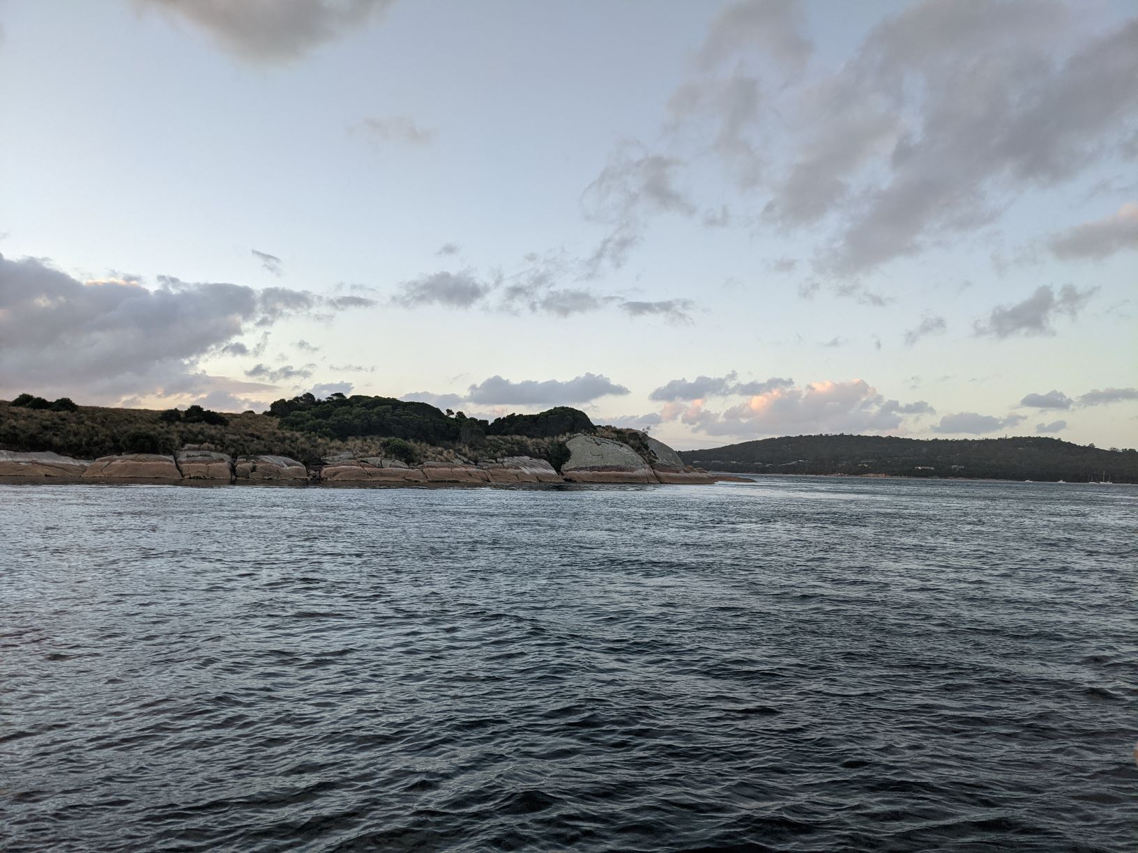
The following day there was no time to recover from our massive bike ride as we finally had good weather to leave Lady Barron and head further north. Before leaving Flinders Island we wanted to try and get to Settlement Point which is just over half way up Flinders near Prime Seal Island. So after quickly stowing the bikes and making the boat seaworthy we caught the appropriate tide and headed off. We didn’t really have too much time to dawdle as we were needed to sail about 30nm if we wanted to make it before dark. However we had the perfect wind which led to an amazing sail, although all day the sky was quite foreboding with overcast heavy looking clouds and a dark sea. But the forecast held true and the worst we had was a couple of annoying light rain showers with a perfect steady 10-15kt breeze. We dropped anchor in the late afternoon off a beautiful white sandy beach in the bay called Port Davies, content to stay on board that night. However the following day we were up early once again to tackle another long walk ashore.
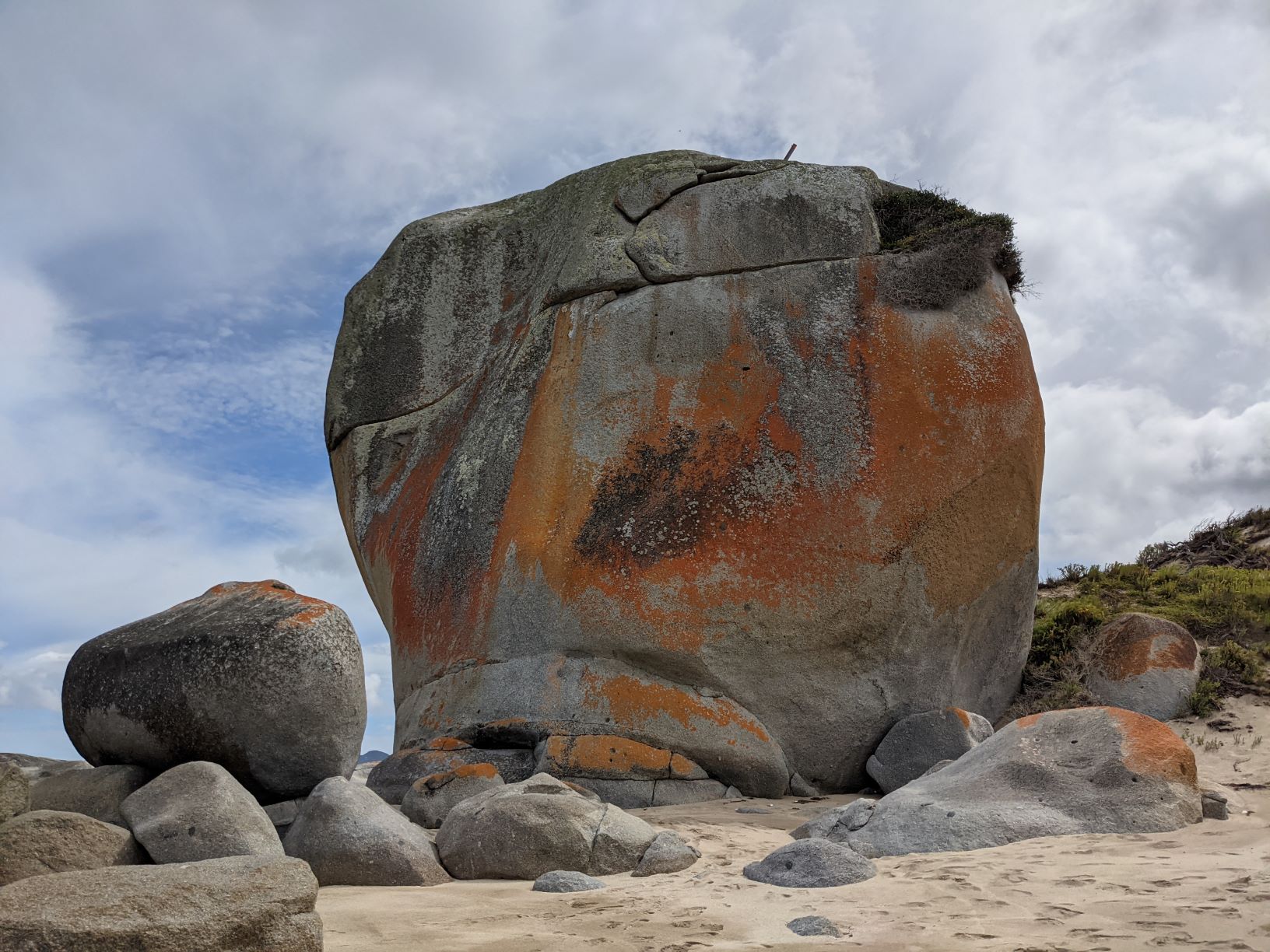
There was a hike along the coast to a place called Castle Rock and a Museum in the local township. So we headed off once again packed full of food and water for another day ashore. The walk out to Castle rock was very lovely and never deviated from the coast, the trail leading us along beaches or the cliffs above. When we finally reach Castle Rock we were amazed, the rock didn’t really look like a castle but was still a stunning feature on the beach. The rock was roughly cube shaped but the size of a small house. It was about 10-15m tall, wide and deep, it was huge and made even Hugo standing beneath it look very small. After a quick morning tea and much gawking at the rock it was time to turn around and head back and see if we could find the museum. When we finally reached the museum we were the first people to arrive having timed our arrival perfectly with the museums opening. We spent about 2hours wandering around the museum which was surprisingly large with a good selection of history on local maritime practices and shipwrecks as well as history on what life on Flinders Island in the early days was like. By the time we finished in the museum it was approaching mid afternoon and we were both ready to head back to the boat which was still a couple of kilometres walk away. So after getting our fill of history we started walking back to the boat and found out once we were on the beach that the wind had picked up. Allagai was safe from dragging however the breeze was more onshore then cross shore which meant our dingy ride back out was a little perilous. With small wind chop forming our little dingy made the trip out to Allagai an adventure with spray coming over the bow while we climbed up and down waves that felt huge in the tiny dingy. However Hugo expertly rowed us out to Allagai with no problems and in no time we were safely back on board only a little wet from the ride out.
This was set to be our last night on Flinders Island as the following day the weather to get us to the Tamar river on the north coast of Tasmania had finally arrived. Our supplies after more then 6 weeks were starting to dwindle and after nearly 3 weeks on Flinders Island we were ready to move on. Our next goal was to reach Launceston which is at the the top of the Tamar River, 40mn inland from the sea.